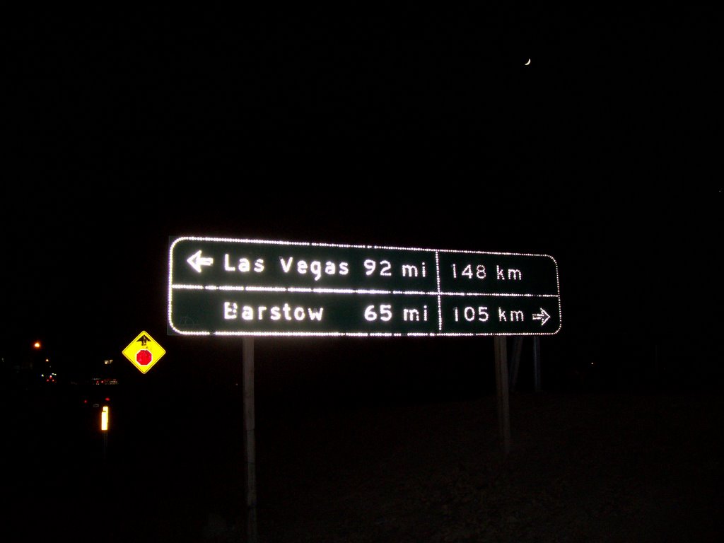
Miles and Kilometers
A while ago on the Roadgeek Yahoogroup, the question arose of where one could see distance signs marked in both miles and kilometers. I couldn't remember the locations of any offhand, but maybe I just hadn't been noticing them. Coming back from Las Vegas, I found one at the southern end of CA-127 in Baker:
Yes, CA-127 is not the normal route to take back to L.A. from Vegas. I had headed west on NV-160 south of Las Vegas to Pahrump, then southwest on NV-372, which quickly crosses the state line and becomes CA-178, which meets up with CA-127 in Shoshone, not far from one entrance to Death Valley.
I took this route just for the scenery; I had never been to Pahrump before, though I had visited Beatty, in the same county. Shoshone is a tiny community of 52 people. There are fewer than a hundred in Tecopa, a few miles away, and aside from the hot springs in Tecopa (I visited once on a Geology field trip as an undergrad) that's pretty much it for miles around. Heading south on CA-127, one crosses Ibex Pass when crossing into San Bernardino County, where some faint lights can be seen in the distance after dark. Those lights are the town of Baker, 40 miles away and the next place you'll see anything besides another vehicle with an electric light.
I also saw another distance sign marked in both miles and kilometers heading south on I-15, six miles north of Victorville. I didn't get a picture. These dual-signed signs were not standard, though; I saw multiple signs marked only in miles on both I-15 and CA-127.
posted by Adam Villani @ 12/09/2005 01:04:00 AM
1 comments
![]()
![]()

1 Comments:
We have some in Kentucky! Way out in the east end of Jefferson County, on I-265, near the I-71 interchange. I don't have any pictures, though.
Post a Comment
<< Home