Clark County Route 215 in Las Vegas
I spent the weekend in Las Vegas tagging along with my fiancee while she attended a pharmacy conference. I left a day before she did (she hitched a ride home with a friend) and scoped out some of the new beltway they're building around the periphery of the city. For now, only the portion starting south of the Strip and heading east to Henderson is signed as an Interstate, I-215. The rest of the road is signed for now as Clark County route 215. Presumably it'll get designated as an Interstate when the whole thing gets built around the west and north sides of town, ending near Nellis Air Force Base. I haven't seen any indication on maps that there will be an eastern leg of this beltway anytime in the near future. For now CC-215 is a weird mixed bag of a highway. Parts of it are freeway, parts are built only to expressway standards (i.e., there are at-grade intersections), and parts are aligned for the time being along the periphery of the right-of-way, which will be the frontage roads for the route once the main roadway in the center of the right-of-way is completed.
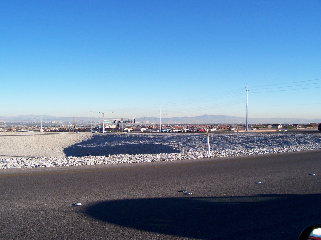
I headed north out of the city along Rancho Rd., former US-95 (I didn't notice any BUS-95 signs on it, though I may have just missed them) and met up with CC-215 at its northern intersection with Jones Rd. Here the road is just an expressway, built almost to freeway standards in a below-grade alignment, but with at-grade intersections. Distressingly, though, was the fact that there was no median between the two directions of travel, only a double yellow line separating the heavy, fast-moving traffic:

West of US-95, there are a couple of full interchanges before reverting back to an expressway. At about the point where the beltway turns from westbound to southbound, you're treated to a commanding view of the whole Las Vegas valley. Unfortunately, I didn't get a picture. The western leg of this road has some of the starkest landscaping I've ever seen, just a big field of naked rocks, looking more like a gravel quarry than anything else:
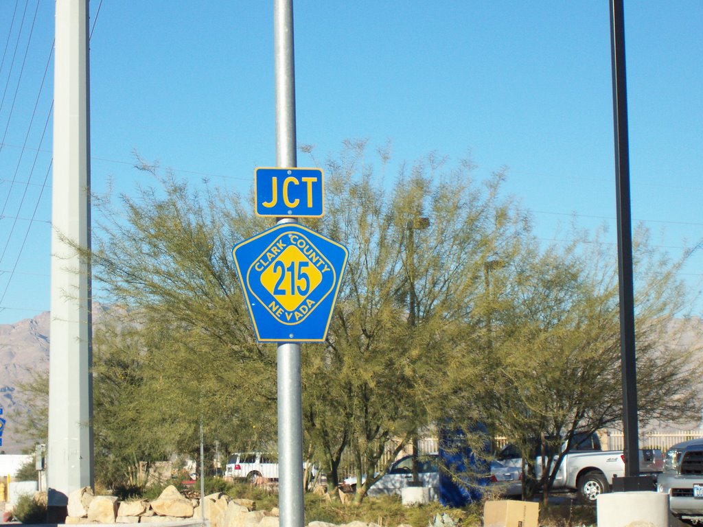
One weird thing I noticed was a subtle change in the shape of the CC-215 shields. North of somewhere around the Far Hills intersection, we see this pentagonal shape familiar as a standard county route marker, although I'd never seen that diamond seal in the middle:
South of that point, though, we still have a pentagon, but the shape is distorted from the standard:
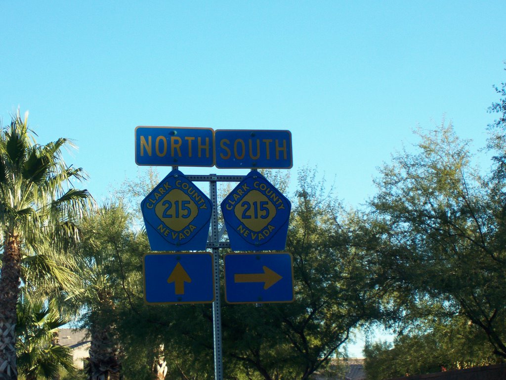
See how the top two sides of the pentagon conform to the shape of the diamond and the overall effect is more squat? I have no idea why they did this. I think the oddly-shaped ones might be in the older-constructed parts of the route, but I'm not sure. The squat pentagons may have even been diamond-shaped signs that the county retrofitted to become pentagons.
If you really want an extensive log of this route and set of photos of it, you can check out this site here, although it hasn't been updated since April of 2004.
posted by Adam Villani @ 12/09/2005 12:14:00 AM
0 comments
![]()
![]()

0 Comments:
Post a Comment
<< Home