Route 66 remnant in Cajon Pass

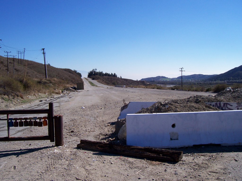
On the same drive that took me up into Lake Arrowhead, I also found an old section of old US-66 in Cajon Pass and took some photos. If you click here, you can see a USGS topo map of the area, found on Topozone.com. Cajon Blvd. is old Route 66 and is the road that parallels the freeway (I-15) to its southwest. Kenwood Ave. is the street crossing the freeway and intersecting with Cajon Blvd. at the red mark. On the map, you can see Cajon Blvd. extending to the southeast for about a mile before dead-ending. Currently, however, Cajon Blvd. is blocked off to the south at the intersection with Kenwood by a big pile of debris and a gate. Here's what that looks like now:
I decided to go for a walk and see how things looked over the hill. Just past the gate, I saw a couple of disinterred "Road Closed" gates.

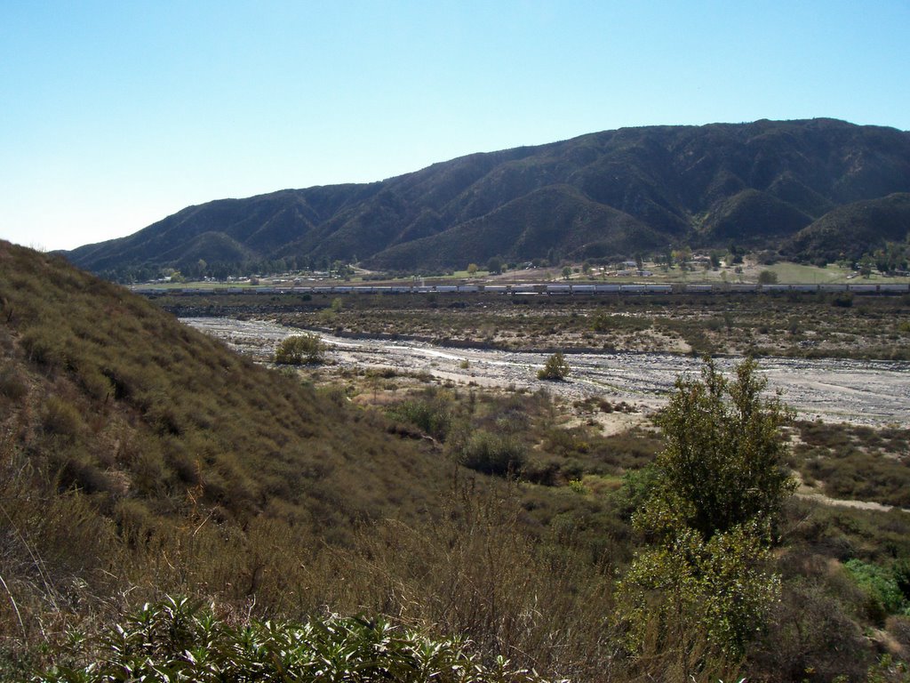
It seemed kind of odd to be walking along what used to be an important highway, carrying thousands upon thousands of people and goods into Southern California. You get a good view of the railroad tracks in the arroyo below. I saw three or for freight trains go by; this would be a great spot for trainspotters.
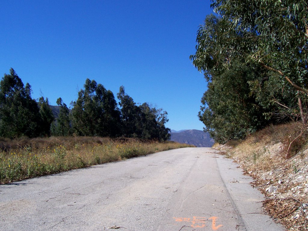
It was a nice, calm walk. Here's how things looked in the area up at the top of the hill (looking northwest). Lots of eucalyptus trees and birds and lizards and such.
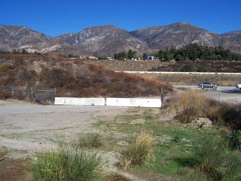
And here's how things looked at the end of the road segment, with just a couple of Jersey barriers and maybe 100 feet of pavement separating the old roadway from Interstate 15.
North of Kenwood Ave., Cajon Blvd. used to be a divided highway with two lanes in each direction. Now, they've closed the northbound lanes to traffic and are using the former southbound lanes as a two-lane highway with traffic in both directions. Here's a view looking south toward Kenwood.

And here's the view looking north from the same spot.

A closeup of the Historic Route 66 sign painted onto the pavement is shown up at the top of this post. This section of 66 is driveable only as far as the next exit from the freeway, Cleghorn Rd., which is a few miles up near the Mormon Rocks. The current road rides alongside the unused former northbound lanes almost the entire way, separated by a median. It doesn't go through to the junction with CA-138, so it doesn't provide an alternate route through the entire pass, only between the Kenwood and Cleghorn exits.
Update: a few more notes on this here.
posted by Adam Villani @ 11/20/2005 03:03:00 PM
1 comments
![]()
![]()

1 Comments:
instructive article on a piece of the famous route 66;
great work. Good pictures.
Bruno
Post a Comment
<< Home